
Walking to the centre of God’s Own
The incredible Pureora Forest Park offers walks throughout its 78,000 hectares.
The establishment of the 78,000 hectare Pureora Forest Park has long been regarded as a hero story in New Zealand’s conservation history.
Thick volcanic ash from the Taupō eruption had blanketed the area providing an ideal growing medium in which podocarps such as matai, rimu, miro and tōtara thrived.
In the 1840’s the area was covered in indigenous forest, but this all changed in 1946 when it became one of the last areas in the North Island to be opened for native forest logging.
Employment and wealth did follow. However, by the 1970’s disquiet over the loss of these slow growing forest giants and an awareness of the treasures being lost, led to the tree top sit-ins of 1978 and the formation of a DOC administered, protected forest park.
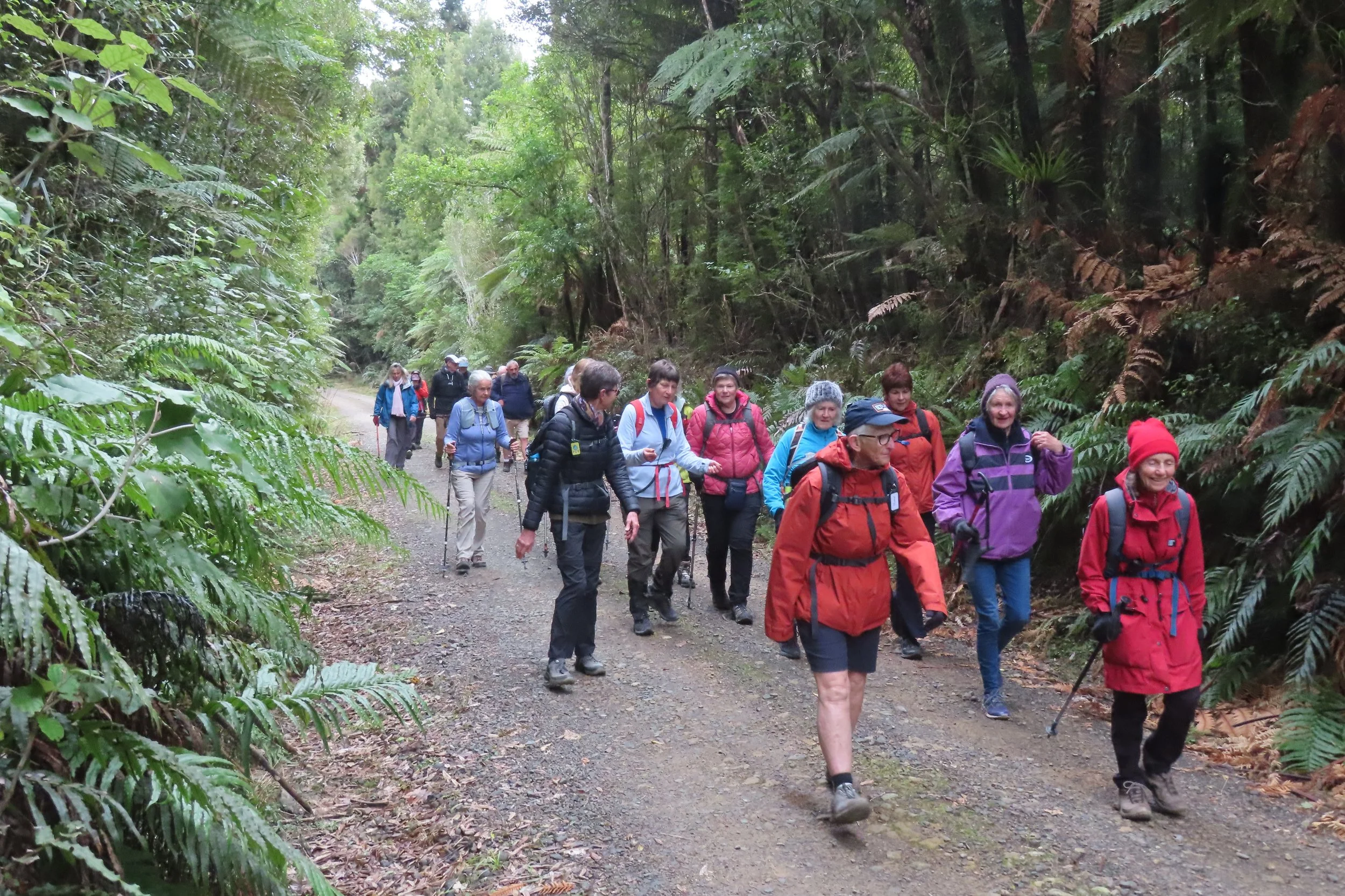
Today we centred our walk on a small section of trails on the outer edge of this vast area.
After a juddering trip down a metal road and squelching across a muddy carpark we were in the peace and quiet of the Centre of the North Island Walk.
Kareao or supple jack formed dense thickets above and around the track and the green of tree ferns and peeling pinkish bark kōtukutuku provided colour to the forest.
We peered up a huge hollow tree with a torch hoping for a glimpse of pekepeka but alas no bats were seen.
An obelisk etched with the technique a local surveyor used to pinpoint this site marks the proposed geographical centre of the North Island.
A cardboard mounted map bent to the curvature of the earth were all part of his method.
The actual centre is also claimed by other locations.
From here we followed old logging roads to the Camp Park Lee YMCA.
A great repurposing of resources as the roads provide links to the Timber Trail and Waikato River Trails Great Ride and a reminder that conservation is not only about the environment but about retaining features of our past.
All along the roadside tōtara, rimu and miro saplings were growing.
High in the canopy were skeletons of trees, devoid of bark and dying but still providing a home for epiphytes, one even had a juvenile lance wood or horoeka growing from an old branch at least 30 feet from the ground.
Despite walking about 7 kilometres on the metal time passed quickly as we chatted, which of course meant few birds were seen or heard.
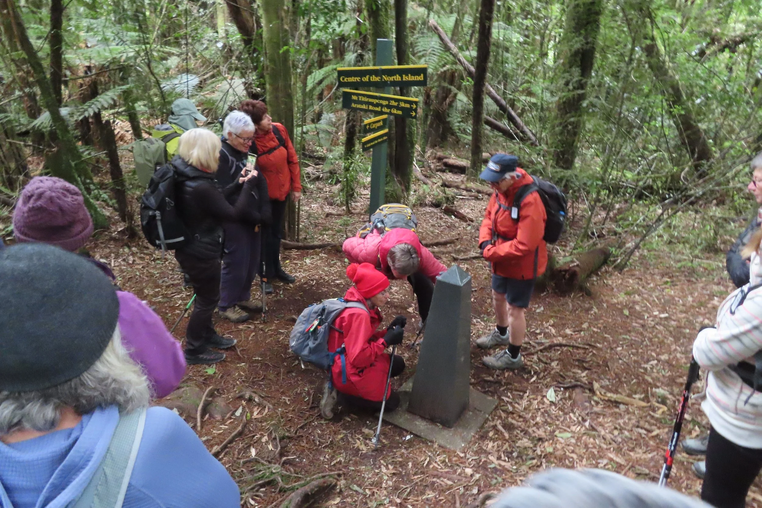
A cairn marks the centre of the North Island.

Reliving the younger days with varying levels of success.
The YMCA is a great off-road facility. We had lunch, seesawing on some wobbly picnic tables before reliving our youth tackling a challenging obstacle course.
We trailed the Burma rope, scaled rope walls, clambered across the stream on rope netting, slid through a big drainpipe, and a few daring souls ‘tarzan’ roped over the water. Not all without calamity.
We located all the pieces of milk bottles on the simple, but ingenious, Milk Trail.
We went down to the stream that could be temporarily dammed to make a perfect swimming hole.
We completed the day with a 5 kilometre walk down the Arataki Track and across a swing bridge.
Again, bushes and trees edged the track which was metal and rutted in places.
A previous bridge across the Mangakino Stream was built in 1978 by the New Zealand Forest Service to give hunters, trampers, cyclists and school groups access.
This became dangerous and had to be closed in 2020.
A new 31 metre suspension style bridge with wire cables and wooden slats was opened in November 2023 with an official blessing in February 2024 thanks to the efforts of DOC and Ngā Hapū o Te Hauauru.
A fun day with a few painful disasters to remind us of our age.
Next week we plan to walk one of Taupō’s shared use tracks.
If you would like more information, please email walkersmondaytaupo@gmail.com or follow us on Facebook at ‘Taupo Monday Walkers’.